Geolocate

Beas River topographic map

Click on the map to display elevation.

About this map

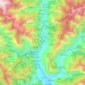
Name: Beas River topographic map, elevation, terrain.

Location: Beas River, Badah, Kullu, Himachal Pradesh, 175101, India (31.88701 77.11078 32.08542 77.14861)

Average elevation: 2,218 m

Minimum elevation: 1,096 m

Maximum elevation: 4,234 m

Gear up for your next adventure:

🥾Trail Running Shoes - Lightweight and durable shoes for trail running
🛏️Sleeping Bag - Warm and compact sleeping bags for outdoor camping
🎒Hiking Backpack - Lightweight and ergonomic backpacks for day hikes or multi-day treks
🎒Backpack Rain Cover - External shield to keep your entire pack dry
🕶️Polarized Sunglasses - Protect your eyes with durable polarized lenses

As an Amazon Associate, this site earns from qualifying purchases at no extra cost to you.