Geolocate

Catania topographic map

Click on the map to display elevation.

About this map
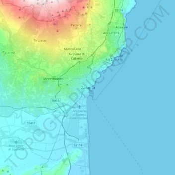
Name: Catania topographic map, elevation, terrain.

Location: Catania, Sicily, Italy (37.34236 14.92737 37.66236 15.24737)

Average elevation: 148 m

Minimum elevation: -1 m

Maximum elevation: 1,174 m

Gear up for your next adventure:

🥽Outdoor Goggles - Protective eyewear for outdoor activities
🧢Hiking Hat - Sun-protective and breathable hats for long treks
🔋Emergency Crank Radio - Weather alerts and power without needing batteries
🦌Outdoor Trail Camera - Monitor wildlife activity near your favorite spots
⛺Camping Essentials - All-in-one gear for a comfortable camping trip

As an Amazon Associate, this site earns from qualifying purchases at no extra cost to you.