Geolocate

Calzada topographic map

Click on the map to display elevation.

About this map

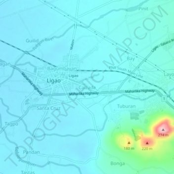
Name: Calzada topographic map, elevation, terrain.

Location: Calzada, Albay, Bicol Region, 4504, Philippines (13.21866 123.52443 13.25866 123.56443)

Average elevation: 61 m

Minimum elevation: 38 m

Maximum elevation: 258 m

Gear up for your next adventure:

🧥Packable Rain Jacket - Breathable waterproof layer for unpredictable weather
🧰Multitool Knife - Compact and versatile tool for outdoor use
🧦Merino Wool Socks - Moisture-wicking comfort for long-distance hiking
🐕Hiking Dog Pack - Let your canine companion carry their own water and food
🧢Hiking Hat - Sun-protective and breathable hats for long treks

As an Amazon Associate, this site earns from qualifying purchases at no extra cost to you.