
Thank you for supporting this site ❤️
Make a donation
Make a donation
Gear up for your next adventure:
As an Amazon Associate, this site earns from qualifying purchases at no extra cost to you.
Carvalhas topographic map
Click on the map to display elevation.
Thank you for supporting this site ❤️
Make a donation
Make a donation
Gear up for your next adventure:
As an Amazon Associate, this site earns from qualifying purchases at no extra cost to you.
About this map
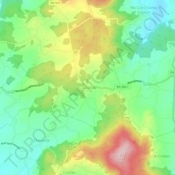
Name: Carvalhas topographic map, elevation, terrain.
Location: Carvalhas, Barcelos, Braga, 4775-050, Portugal (41.45100 -8.61530 41.49100 -8.57530)
Average elevation: 145 m
Minimum elevation: 50 m
Maximum elevation: 301 m
Thank you for supporting this site ❤️
Make a donation
Make a donation
Gear up for your next adventure:
As an Amazon Associate, this site earns from qualifying purchases at no extra cost to you.