Geolocate

Koru topographic map

Click on the map to display elevation.

About this map

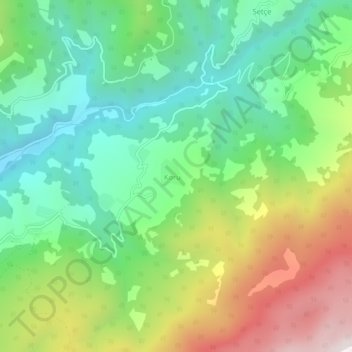
Name: Koru topographic map, elevation, terrain.

Location: Koru, Geyve, Sakarya, Marmara Region, Turkey (40.49483 30.41861 40.53483 30.45861)

Average elevation: 702 m

Minimum elevation: 268 m

Maximum elevation: 1,476 m

Gear up for your next adventure:

🧊Insulated Water Bottle - Keeps drinks cold in summer and prevents freezing in winter
🥾All-Terrain Hiking Boots - Versatile boots for varied hiking conditions
👟Trail Running Shoes - Agile footwear for fast-paced topographic exploration
🔥Camping Stove - Portable stoves to cook outdoors with ease
💡Solar Camping Lamp - Eco-friendly lighting for campsites

As an Amazon Associate, this site earns from qualifying purchases at no extra cost to you.