Geolocate

Windsbach topographic map

Click on the map to display elevation.

About this map

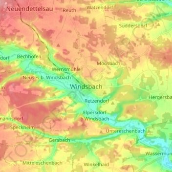
Name: Windsbach topographic map, elevation, terrain.

Location: Windsbach, Landkreis Ansbach, Bayern, 91575, Deutschland (49.20892 10.78906 49.28892 10.86906)

Average elevation: 416 m

Minimum elevation: 368 m

Maximum elevation: 457 m

Gear up for your next adventure:

🧰Emergency Multi-Tool - Compact multi-tool for outdoor survival
🦶Anti-Blister Balm - Prevents friction and hotspots during long ascents
🪑Insulated Seat Pad - Protect your seat from cold rocks and wet logs
🕶️Polarized Sunglasses - Reduces glare from snow and water at high elevations
🐕Hiking Dog Pack - Let your canine companion carry their own water and food

As an Amazon Associate, this site earns from qualifying purchases at no extra cost to you.