Geolocate

Ashtabula topographic map

Click on the map to display elevation.

About this map

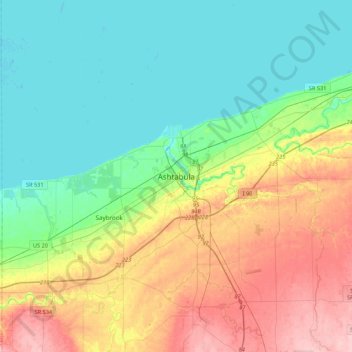
Name: Ashtabula topographic map, elevation, terrain.

Location: Ashtabula, Ashtabula County, Ohio, 44004, United States (41.70505 -80.94981 42.02505 -80.62981)

Average elevation: 219 m

Minimum elevation: 170 m

Maximum elevation: 320 m

Gear up for your next adventure:

📷Outdoor Action Camera - Capture high-elevation views and rugged adventures
Camping Coffee Maker - Brew fresh coffee anywhere on the topographic map
🧢Outdoor Visor - Breathable visor for sunny hikes
🕶️Polarized Sunglasses - Protect your eyes with durable polarized lenses
🧥Waterproof Hiking Jacket - Protect yourself from rain and wind while hiking

As an Amazon Associate, this site earns from qualifying purchases at no extra cost to you.