Geolocate

White County topographic map

Click on the map to display elevation.

About this map

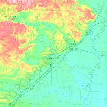
Name: White County topographic map, elevation, terrain.

Location: White County, Arkansas, United States (35.02115 -92.11979 35.53406 -91.34439)

Average elevation: 111 m

Minimum elevation: 49 m

Maximum elevation: 335 m

Other topographic maps

Click on a map to view its topography, its elevation and its terrain.

Starkey Hill

United States > Arkansas > White County

Average elevation: 215 m

Gear up for your next adventure:

🥘Camping Cookware Set - Compact nesting pots and pans for trail cooking
🔦UV Flashlight - Detect minerals or specific insects in the dark
💡LED Camping Lantern - Illuminate your campsite with long-lasting lanterns
Bushcraft Tarp - Versatile emergency shelter or gear protection
🔋Emergency Crank Radio - Weather alerts and power without needing batteries

As an Amazon Associate, this site earns from qualifying purchases at no extra cost to you.