
Thank you for supporting this site ❤️
Make a donation
Make a donation
Gear up for your next adventure:
As an Amazon Associate, this site earns from qualifying purchases at no extra cost to you.
Atotonilco topographic map
Click on the map to display elevation.
Thank you for supporting this site ❤️
Make a donation
Make a donation
Gear up for your next adventure:
As an Amazon Associate, this site earns from qualifying purchases at no extra cost to you.
About this map
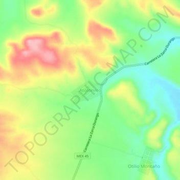
Name: Atotonilco topographic map, elevation, terrain.
Location: Atotonilco, San Juan del Río, Durango, México (24.82246 -104.50517 24.86246 -104.46517)
Average elevation: 1,689 m
Minimum elevation: 1,621 m
Maximum elevation: 1,775 m
Thank you for supporting this site ❤️
Make a donation
Make a donation
Gear up for your next adventure:
As an Amazon Associate, this site earns from qualifying purchases at no extra cost to you.