
Blankenfelde-Mahlow topographic map
Interactive map
Click on the map to display elevation.
About this map
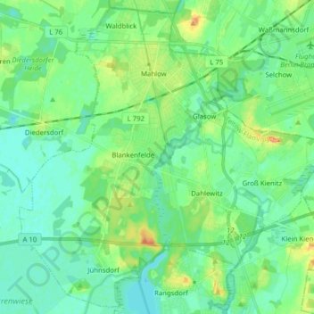
Name: Blankenfelde-Mahlow topographic map, elevation, terrain.
Location: Blankenfelde-Mahlow, Teltow-Fläming, Brandenburg, Deutschland (52.28712 13.34353 52.37786 13.49907)
Average elevation: 43 m
Minimum elevation: 33 m
Maximum elevation: 66 m