
Make a donation
Gear up for your next adventure:
As an Amazon Associate, this site earns from qualifying purchases at no extra cost to you.
Sabadell topographic map
Click on the map to display elevation.
Make a donation
Gear up for your next adventure:
As an Amazon Associate, this site earns from qualifying purchases at no extra cost to you.
Sabadell
The city covers an area of 37.79 km2 (14.59 sq mi) and its population density is 5,337.57/km2 (13,824.2/sq mi) as of 2007. The altitude is 200 metres (660 ft).
Make a donation
Gear up for your next adventure:
As an Amazon Associate, this site earns from qualifying purchases at no extra cost to you.
About this map
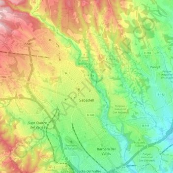
Name: Sabadell topographic map, elevation, terrain.
Location: Sabadell, Vallès Occidental, Barcelona, Catalonia, Spain (41.50657 2.04689 41.59055 2.15016)
Average elevation: 183 m
Minimum elevation: 69 m
Maximum elevation: 333 m
Make a donation
Gear up for your next adventure:
As an Amazon Associate, this site earns from qualifying purchases at no extra cost to you.