
Rodeiro topographic map
Interactive map
Click on the map to display elevation.
About this map
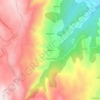
Name: Rodeiro topographic map, elevation, terrain.
Location: Rodeiro, Orense, Galicia, España (42.34785 -8.31978 42.38785 -8.27978)
Average elevation: 732 m
Minimum elevation: 347 m
Maximum elevation: 1,041 m