
Danville topographic map
Interactive map
Click on the map to display elevation.
About this map
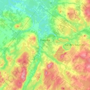
Name: Danville topographic map, elevation, terrain.
Location: Danville, Les Sources, Estrie, Quebec, Canada (45.69880 -72.13377 45.85342 -71.88021)
Average elevation: 205 m
Minimum elevation: 98 m
Maximum elevation: 390 m