Geolocate

Huarmaca topographic map

Click on the map to display elevation.

About this map
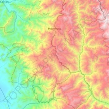
Name: Huarmaca topographic map, elevation, terrain.

Location: Huarmaca, Province of Huancabamba, Piura, Peru (-5.97010 -79.83944 -5.42487 -79.33357)

Average elevation: 1,596 m

Minimum elevation: 120 m

Maximum elevation: 3,866 m

Gear up for your next adventure:

🏃Hydration Running Vest - Carry water and maps close to your body for speed
🛶Waterproof Dry Bags - Keep electronics and clothes dry during river crossings
🧢Hiking Hat - Sun-protective and breathable hats for long treks
🥽Outdoor Goggles - Protective eyewear for outdoor activities
🥫Freeze-Dried Meals - Lightweight, high-calorie nutrition for multi-day treks

As an Amazon Associate, this site earns from qualifying purchases at no extra cost to you.