Geolocate

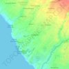
Beraban topographic map

Click on the map to display elevation.

About this map

Name: Beraban topographic map, elevation, terrain.

Location: Beraban, Kediri, Tabanan, Bali, 82121, Indonesia (-8.63728 115.08489 -8.59228 115.11365)

Average elevation: 23 m

Minimum elevation: 0 m

Maximum elevation: 69 m

Other topographic maps

Click on a map to view its topography, its elevation and its terrain.
Batugaing

Indonesia > Bali > Kediri > Beraban

Average elevation: 23 m

Gear up for your next adventure:

⛺Bushcraft Tarp - Versatile emergency shelter or gear protection
🛌Insulated Sleeping Pad - Critical thermal barrier between you and the cold ground
🥾Hiking Shorts - Breathable shorts suitable for summer hikes
🥾Approach Shoes - Shoes designed for climbing approaches and rugged trails
👟Sport Hiking Sandals - Breathable footwear for water crossings and camp rest

As an Amazon Associate, this site earns from qualifying purchases at no extra cost to you.