Geolocate

Chataigne topographic map

Click on the map to display elevation.

About this map
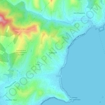
Name: Chataigne topographic map, elevation, terrain.

Location: Chataigne, Sainte-Maxime, Draguignan, Var, Provence-Alpes-Côte d'Azur, France métropolitaine, 83120, France (43.31140 6.64082 43.35140 6.68082)

Average elevation: 51 m

Minimum elevation: -1 m

Maximum elevation: 268 m

Other topographic maps

Click on a map to view its topography, its elevation and its terrain.

83120

France > Provence-Alpes-Côte d'Azur > Var > Sainte-Maxime

Average elevation: 169 m

Gear up for your next adventure:

🧥Waterproof Jacket - Lightweight rain jackets for hiking and outdoor activities
🔦LED Flashlight - Powerful and long-lasting flashlight for camping and emergencies
🛌Down Sleeping Bag - Superior warmth-to-weight ratio for cold nights
🧢Outdoor Visor - Breathable visor for sunny hikes
🛌Insulated Sleeping Pad - Critical thermal barrier between you and the cold ground

As an Amazon Associate, this site earns from qualifying purchases at no extra cost to you.