Geolocate

Oromocto topographic map

Click on the map to display elevation.

About this map

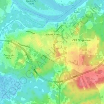
Name: Oromocto topographic map, elevation, terrain.

Location: Oromocto, Sunbury County, New Brunswick, Canada (45.81164 -66.53486 45.86117 -66.44113)

Average elevation: 24 m

Minimum elevation: -2 m

Maximum elevation: 73 m

New Brunswick trails, hiking, mountain biking, running and outdoor activities

Gear up for your next adventure:

🔪Outdoor Multitool - Versatile tool for repairs and food prep in the wild
Lightweight Backpacking Tent - Compact tent for efficient hiking trips
🛏️Camping Sleeping Mat - Comfortable mats for sleeping outdoors
🚲MTB Frame Bag - Carry tools and maps directly on your bicycle frame
🛏️Sleeping Bag - Warm and compact sleeping bags for outdoor camping

As an Amazon Associate, this site earns from qualifying purchases at no extra cost to you.