Geolocate

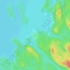
Lac Lippe topographic map

Click on the map to display elevation.

About this map

Name: Lac Lippe topographic map, elevation, terrain.

Location: Lac Lippe, Lac-Pythonga, La Vallée-de-la-Gatineau, Outaouais, Québec, Canada (47.38400 -76.56777 47.38592 -76.56519)

Average elevation: 368 m

Minimum elevation: 353 m

Maximum elevation: 424 m

Other topographic maps

Click on a map to view its topography, its elevation and its terrain.

Gear up for your next adventure:

🥾Trail Hiking Socks - Comfortable socks to prevent blisters and fatigue
🥾Waterproof Hiking Shoes - Durable shoes for wet and rugged trails
⛺Bushcraft Tarp - Versatile emergency shelter or gear protection
🥾Lightweight Hiking Boots - Boots for comfort and mobility on long hikes
⛺Camping Groundsheet - Protect your tent from moisture and dirt

As an Amazon Associate, this site earns from qualifying purchases at no extra cost to you.