Geolocate

Johnstown topographic map

Click on the map to display elevation.

About this map

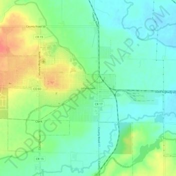
Name: Johnstown topographic map, elevation, terrain.

Location: Johnstown, Weld County, Colorado, 80534, United States (40.31503 -104.92928 40.35503 -104.88928)

Average elevation: 1,471 m

Minimum elevation: 1,450 m

Maximum elevation: 1,507 m

Gear up for your next adventure:

💡LED Headlamp - Hands-free illumination for night hiking and camping
🥾Approach Shoes - Shoes designed for climbing approaches and rugged trails
🥾Light Trekking Boots - Supportive boots for multi-day treks
💧Filtered Water Bottle - Safe drinking water on the go
🛶Kayak Dry Bag - Waterproof storage for kayaking adventures

As an Amazon Associate, this site earns from qualifying purchases at no extra cost to you.