
Thank you for supporting this site ❤️
Make a donation
Make a donation
Gear up for your next adventure:
As an Amazon Associate, this site earns from qualifying purchases at no extra cost to you.
Torre topographic map
Click on the map to display elevation.
Thank you for supporting this site ❤️
Make a donation
Make a donation
Gear up for your next adventure:
As an Amazon Associate, this site earns from qualifying purchases at no extra cost to you.
About this map
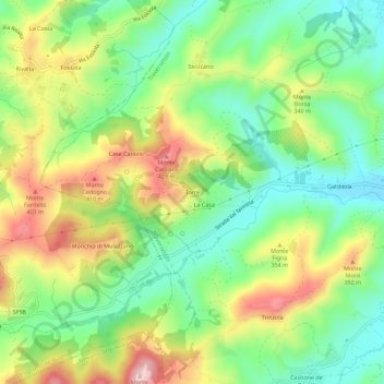
Name: Torre topographic map, elevation, terrain.
Location: Torre, Traversetolo, Parma, Emilia-Romagna, 43029, Italy (44.59949 10.32621 44.63949 10.36621)
Average elevation: 292 m
Minimum elevation: 182 m
Maximum elevation: 453 m
Thank you for supporting this site ❤️
Make a donation
Make a donation
Gear up for your next adventure:
As an Amazon Associate, this site earns from qualifying purchases at no extra cost to you.