Geolocate

Talawade topographic map

Click on the map to display elevation.

About this map

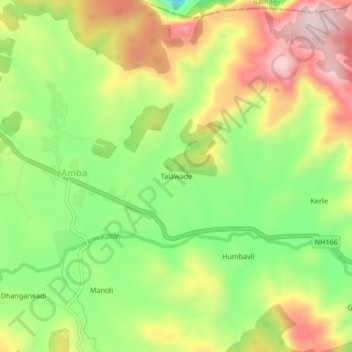
Name: Talawade topographic map, elevation, terrain.

Location: Talawade, Amba, Shahuwadi, Kolhapur, Maharashtra, India (16.95094 73.79014 16.99094 73.83014)

Average elevation: 634 m

Minimum elevation: 466 m

Maximum elevation: 820 m

Gear up for your next adventure:

🥾Mountain Trail Shoes - High-traction shoes for mountain trails
💡Portable Camping Lamp - Rechargeable lamp for campsite lighting
🧭GPS Handheld Device - Reliable GPS navigation for outdoor adventures
🔦LED Flashlight - Powerful and long-lasting flashlight for camping and emergencies
🧥Softshell Jacket - Windproof and breathable jacket for hiking

As an Amazon Associate, this site earns from qualifying purchases at no extra cost to you.