
Wagrain topographic map
Click on the map to display elevation.
About this map
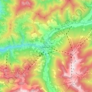
Name: Wagrain topographic map, elevation, terrain.
Location: Wagrain, Bezirk St. Johann im Pongau, Salzburg, 5602, Austria (47.28430 13.25732 47.38489 13.36522)
Average elevation: 1,300 m
Minimum elevation: 704 m
Maximum elevation: 2,002 m
Other topographic maps
Click on a map to view its topography, its elevation and its terrain.
Zauchensee
Austria > Salzburg > Bezirk St. Johann im Pongau > Altenmarkt im Pongau
Average elevation: 1,696 m
Rohrmoos
Austria > Salzburg > Bezirk St. Johann im Pongau > Mühlbach am Hochkönig
Average elevation: 1,103 m