Geolocate

Los Cabos topographic map

Click on the map to display elevation.

About this map

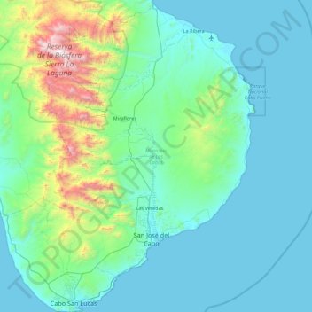
Name: Los Cabos topographic map, elevation, terrain.

Location: Los Cabos, Baja California Sur, Mexico (22.87164 -110.12066 23.67148 -109.41317)

Average elevation: 278 m

Minimum elevation: 0 m

Maximum elevation: 2,054 m

Gear up for your next adventure:

🥾Waterproof Hiking Boots - Essential footwear for rugged terrain and wet Canadian trails
🧼Travel Hand Sanitizer - Keep hands clean when water is scarce
🛰️Satellite Messenger - Emergency communication for areas with no cell service
Camping Tent - Weather-resistant tents suitable for 2 to 6 people
🎒Hiking Daypack - Lightweight and durable backpacks for day trips and excursions

As an Amazon Associate, this site earns from qualifying purchases at no extra cost to you.