
Толмань topographic map
Interactive map
Click on the map to display elevation.
About this map
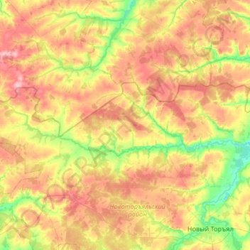
Name: Толмань topographic map, elevation, terrain.
Average elevation: 162 m
Minimum elevation: 110 m
Maximum elevation: 219 m
Other topographic maps
Click on a map to view its topography, its elevation and its terrain.
Yoshkar-Ola
Russia > Mari El > Yoshkar-Ola
Yoshkar-Ola, Mari El, Volga Federal District, Russia
Average elevation: 103 m