
Lassing topographic map
Interactive map
Click on the map to display elevation.
About this map
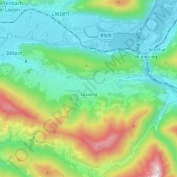
Name: Lassing topographic map, elevation, terrain.
Location: Lassing, Liezen, Stiermarken, 8903, Oostenrijk (47.50068 14.18919 47.55889 14.32136)
Average elevation: 956 m
Minimum elevation: 620 m
Maximum elevation: 1,842 m