Geolocate

Layo topographic map

Click on the map to display elevation.

About this map

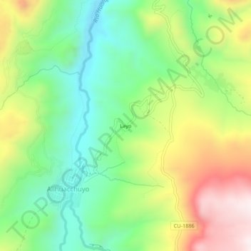
Name: Layo topographic map, elevation, terrain.

Location: Layo, Allhuacchuyo, Santo Tomás, Chumbivilcas, Cusco, Perú (-14.64631 -72.16007 -14.60631 -72.12007)

Average elevation: 4,110 m

Minimum elevation: 3,830 m

Maximum elevation: 4,536 m

Gear up for your next adventure:

🛁Quick-Dry Microfiber Towel - Space-saving towel that dries rapidly on the move
💡Solar Camping Lamp - Eco-friendly lighting for campsites
🦯Trekking Poles - Reduced impact on joints for steep topographic climbs
🥾Durable Hiking Shoes - Long-lasting shoes for frequent hiking
🥾Hiking Shoes - Durable and comfortable shoes for trail hiking

As an Amazon Associate, this site earns from qualifying purchases at no extra cost to you.