
Thank you for supporting this site ❤️
Make a donation
Make a donation
Gear up for your next adventure:
As an Amazon Associate, this site earns from qualifying purchases at no extra cost to you.
Peñaverde topographic map
Click on the map to display elevation.
Thank you for supporting this site ❤️
Make a donation
Make a donation
Gear up for your next adventure:
As an Amazon Associate, this site earns from qualifying purchases at no extra cost to you.
About this map
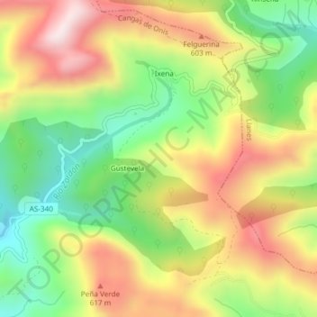
Name: Peñaverde topographic map, elevation, terrain.
Location: Peñaverde, Gustevela, Cangas de Onís, Astúrias, Espanha (43.37657 -5.02903 43.39657 -5.00903)
Average elevation: 438 m
Minimum elevation: 183 m
Maximum elevation: 717 m
Thank you for supporting this site ❤️
Make a donation
Make a donation
Gear up for your next adventure:
As an Amazon Associate, this site earns from qualifying purchases at no extra cost to you.