
Danvers topographic map
Click on the map to display elevation.
Danvers
Though being at sea level in the Danversport area, the town has numerous hills reaching around 130 to 180 feet in elevation, including Dales Hill (located at St. John's Preparatory School), Ferncroft Hill, Folly Hill, Hathorne Hill, Lindall Hill, Nichols Hill, Putnam Hill, Rocky Hill and Whipple Hill (part of Endicott Park).
About this map
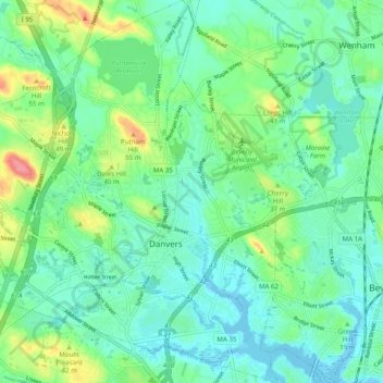
Name: Danvers topographic map, elevation, terrain.
Location: Danvers, Essex County, Massachusetts, United States (42.54016 -71.00281 42.61324 -70.90762)
Average elevation: 22 m
Minimum elevation: -2 m
Maximum elevation: 81 m