Geolocate

town square topographic map

Click on the map to display elevation.

About this map

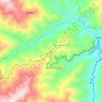
Name: town square topographic map, elevation, terrain.

Location: town square, Chizami, Phek, Nagaland, 797102, India (25.55465 94.34516 25.63465 94.42516)

Average elevation: 1,324 m

Minimum elevation: 786 m

Maximum elevation: 2,143 m

Gear up for your next adventure:

🥾Hiking Shorts - Breathable shorts suitable for summer hikes
🦟Insect Repellent - Keep mosquitoes and black flies away in wooded areas
🎒Backpack Rain Cover - External shield to keep your entire pack dry
🥾Mountaineering Boots - Supportive boots for climbing and high-altitude hiking
🗺️Topographic Maps - Detailed maps to explore trails, mountains, and wilderness areas

As an Amazon Associate, this site earns from qualifying purchases at no extra cost to you.