Geolocate

Cumbres topographic map

Click on the map to display elevation.

About this map

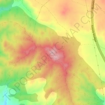
Name: Cumbres topographic map, elevation, terrain.

Location: Cumbres, Calamocha, Jiloca, Teruel, Aragon, Spain (41.00239 -1.28248 41.00249 -1.28238)

Average elevation: 1,020 m

Minimum elevation: 909 m

Maximum elevation: 1,098 m

Gear up for your next adventure:

🥾Trail Hiking Boots - Supportive boots for rough trails
🥾Mountain Trail Shoes - High-traction shoes for mountain trails
Camping Tent - Weather-resistant tents suitable for 2 to 6 people
🧭GPS Tracker - Track your location in remote areas safely
🥾Hiking Shoes - Durable and comfortable shoes for trail hiking

As an Amazon Associate, this site earns from qualifying purchases at no extra cost to you.