Geolocate

Brenham topographic map

Click on the map to display elevation.

About this map

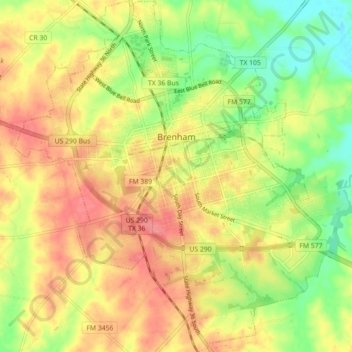
Name: Brenham topographic map, elevation, terrain.

Location: Brenham, Washington County, Texas, United States (30.11981 -96.43869 30.19663 -96.36008)

Average elevation: 98 m

Minimum elevation: 60 m

Maximum elevation: 129 m

Gear up for your next adventure:

🛰️Satellite Messenger - Emergency communication for areas with no cell service
Camping Tent - Weather-resistant tents suitable for 2 to 6 people
🥫Freeze-Dried Meals - Lightweight, high-calorie nutrition for multi-day treks
🥾Waterproof Hiking Shoes - Durable shoes for wet and rugged trails
Camping Essentials - All-in-one gear for a comfortable camping trip

As an Amazon Associate, this site earns from qualifying purchases at no extra cost to you.