Geolocate

Clama topographic map

Click on the map to display elevation.

About this map

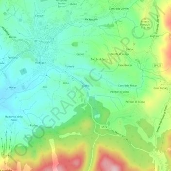
Name: Clama topographic map, elevation, terrain.

Location: Clama, Asiago, Vicenza, Veneto, 36012, Italy (45.84503 11.50424 45.88503 11.54424)

Average elevation: 1,055 m

Minimum elevation: 968 m

Maximum elevation: 1,235 m

Gear up for your next adventure:

👟Leg Gaiters - Keep debris, mud, and snow out of your boots
Camping Tent - Weather-resistant tents suitable for 2 to 6 people
💧Filtered Water Bottle - Safe drinking water on the go
🧣Merino Neck Gaiter - Protects against wind, sun, and cold at high altitudes
🔦UV Flashlight - Detect minerals or specific insects in the dark

As an Amazon Associate, this site earns from qualifying purchases at no extra cost to you.