Geolocate

Ellora topographic map

Click on the map to display elevation.

About this map

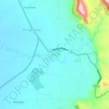
Name: Ellora topographic map, elevation, terrain.

Location: Ellora, Khuldabad, Aurangabad, Maharashtra, India (20.00314 75.14308 20.04314 75.18308)

Average elevation: 623 m

Minimum elevation: 579 m

Maximum elevation: 856 m

Gear up for your next adventure:

🧦Outdoor Socks - Durable socks designed for hiking and outdoor sports
🦌Outdoor Trail Camera - Monitor wildlife activity near your favorite spots
🥾Waterproof Hiking Boots - Essential footwear for rugged terrain and wet Canadian trails
🧤Thermal Hiking Gloves - Grip-enhanced gloves for cold-weather altitude trekking
🎒Hiking Backpack - Lightweight and ergonomic backpacks for day hikes or multi-day treks

As an Amazon Associate, this site earns from qualifying purchases at no extra cost to you.