
Make a donation
Gear up for your next adventure:
As an Amazon Associate, this site earns from qualifying purchases at no extra cost to you.
Oordegem topographic map
Click on the map to display elevation.
Make a donation
Gear up for your next adventure:
As an Amazon Associate, this site earns from qualifying purchases at no extra cost to you.
Oordegem
Oordegem ligt in Zandlemig Vlaanderen. De hoogte bedraagt ongeveer 40 meter. De belangrijkste waterloop is de Molenbeek die in noordelijke richting naar de Schelde stroomt.
Make a donation
Gear up for your next adventure:
As an Amazon Associate, this site earns from qualifying purchases at no extra cost to you.
About this map
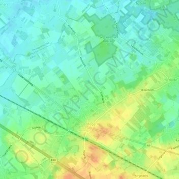
Name: Oordegem topographic map, elevation, terrain.
Location: Oordegem, Lede, Aalst, Oost-Vlaanderen, Vlaanderen, België (50.94755 3.86754 50.98072 3.92345)
Average elevation: 24 m
Minimum elevation: 10 m
Maximum elevation: 47 m
Make a donation
Gear up for your next adventure:
As an Amazon Associate, this site earns from qualifying purchases at no extra cost to you.