
Make a donation
Gear up for your next adventure:
As an Amazon Associate, this site earns from qualifying purchases at no extra cost to you.
Tobermory topographic map
Click on the map to display elevation.
Make a donation
Gear up for your next adventure:
As an Amazon Associate, this site earns from qualifying purchases at no extra cost to you.
Tobermory
The deep waters at the mouth of Georgian Bay are home to Fathom Five, Canada's first National Marine Conservation Area. The park preserves a rich cultural legacy that includes 22 shipwrecks and several historic lighthouses. Fathom Five's freshwater ecosystem contains some of the most pristine waters of the Great Lakes. The rugged islands of the park are a reminder of the impressive lake-bed topography found beneath the waves. There are glass-bottom cruises at Tobermory which offer tours to the park, as well as the rugged north coast of the Bruce Peninsula.
Make a donation
Gear up for your next adventure:
As an Amazon Associate, this site earns from qualifying purchases at no extra cost to you.
About this map
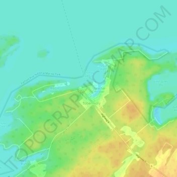
Name: Tobermory topographic map, elevation, terrain.
Average elevation: 182 m
Minimum elevation: 170 m
Maximum elevation: 201 m
Ontario trails, hiking, mountain biking, running and outdoor activities
Make a donation
Gear up for your next adventure:
As an Amazon Associate, this site earns from qualifying purchases at no extra cost to you.