Geolocate

Dundalk topographic map

Click on the map to display elevation.

About this map

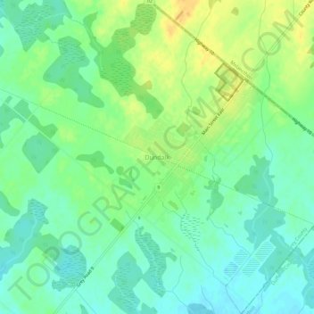
Name: Dundalk topographic map, elevation, terrain.

Location: Dundalk, Southgate, Grey County, Ontario, N0C 1B0, Canada (44.14915 -80.41658 44.18915 -80.37658)

Average elevation: 516 m

Minimum elevation: 503 m

Maximum elevation: 535 m

Grey County trails, hiking, mountain biking, running and outdoor activities

Gear up for your next adventure:

🥾Lightweight Hiking Shoes - Comfortable shoes for day hikes
🛌Insulated Sleeping Pad - Critical thermal barrier between you and the cold ground
💡Compact LED Flashlight - Powerful and portable flashlight for outdoor use
🔨Vehicle Emergency Tool - Safety tool for remote road trips to trailheads
💡Solar Camping Lamp - Eco-friendly lighting for campsites

As an Amazon Associate, this site earns from qualifying purchases at no extra cost to you.