Geolocate

Eldora topographic map

Click on the map to display elevation.

About this map

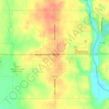
Name: Eldora topographic map, elevation, terrain.

Location: Eldora, Hardin County, Iowa, 50627, United States (42.34616 -93.12842 42.37531 -93.07981)

Average elevation: 315 m

Minimum elevation: 285 m

Maximum elevation: 338 m

Gear up for your next adventure:

🥾All-Terrain Hiking Boots - Versatile boots for varied hiking conditions
🧼Biodegradable Camp Soap - Environmentally friendly cleaning for gear and body
🧥Softshell Jacket - Windproof and breathable jacket for hiking
🛌Insulated Sleeping Pad - Critical thermal barrier between you and the cold ground
🥾Trail Hiking Shoes - Durable shoes designed for rugged trails

As an Amazon Associate, this site earns from qualifying purchases at no extra cost to you.