Geolocate

Earness topographic map

Click on the map to display elevation.

About this map

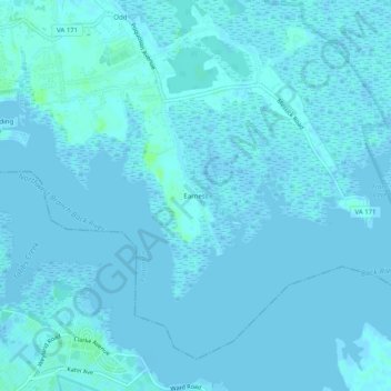
Name: Earness topographic map, elevation, terrain.

Location: Earness, Poquoson, Virginia, 23662, United States (37.09098 -76.36133 37.13098 -76.32133)

Average elevation: 1 m

Minimum elevation: -2 m

Maximum elevation: 9 m

Gear up for your next adventure:

🚲Heavy Duty Bike Lock - Secure your bike at the trailhead or during stops
🛰️Satellite Messenger - Emergency communication for areas with no cell service
Camping Tent - Weather-resistant tents suitable for 2 to 6 people
🔭Compact Monocular - One-handed bird watching and trail spotting
🔪Outdoor Multitool - Versatile tool for repairs and food prep in the wild

As an Amazon Associate, this site earns from qualifying purchases at no extra cost to you.