Geolocate

Uckermark topographic map

Click on the map to display elevation.

About this map

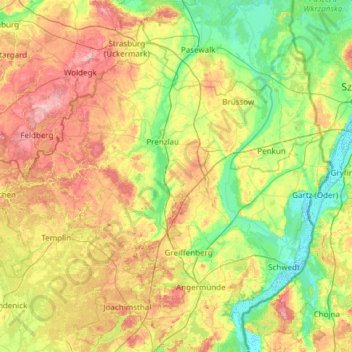
Name: Uckermark topographic map, elevation, terrain.

Location: Uckermark, Brandenburg, Germany (52.93149 13.23978 53.55909 14.45057)

Average elevation: 53 m

Minimum elevation: -5 m

Maximum elevation: 163 m

Other topographic maps

Click on a map to view its topography, its elevation and its terrain.

Gear up for your next adventure:

🥾Trail Hiking Socks - Comfortable socks to prevent blisters and fatigue
🔭Compact Binoculars - Lightweight optics for scouting trails and wildlife
💡LED Headlamp - Hands-free illumination for night hiking and camping
🧭GPS Outdoor Watch - Smart watch for navigation and fitness tracking in nature
🧦Outdoor Socks - Durable socks designed for hiking and outdoor sports

As an Amazon Associate, this site earns from qualifying purchases at no extra cost to you.