Geolocate

Teterboro topographic map

Click on the map to display elevation.

About this map

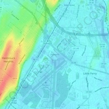
Name: Teterboro topographic map, elevation, terrain.

Location: Teterboro, Bergen County, New Jersey, 07608, United States (40.83982 -74.07931 40.87982 -74.03931)

Average elevation: 12 m

Minimum elevation: -4 m

Maximum elevation: 57 m

Gear up for your next adventure:

Family Camping Tent - Spacious tent suitable for family camping trips
🧴Bear Spray Holster - Quick-access carry for essential Canadian wilderness safety
💡LED Headlamp - Hands-free illumination for night hiking and camping
🥾Hiking Leggings - Comfortable leggings for outdoor activities
🧢Outdoor Cap - Protective cap for sun and rain during hikes

As an Amazon Associate, this site earns from qualifying purchases at no extra cost to you.