Geolocate

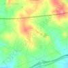
Renau topographic map

Click on the map to display elevation.

About this map

Name: Renau topographic map, elevation, terrain.

Location: Renau, Tarragonés, Tarragona, Cataluña, 43886, España (41.19806 1.29081 41.23939 1.34271)

Average elevation: 167 m

Minimum elevation: 82 m

Maximum elevation: 241 m

Other topographic maps

Click on a map to view its topography, its elevation and its terrain.

Sant Simplici

España > Cataluña > Tarragonés > Tarragona

Average elevation: 41 m

Costa de la Toia

España > Cataluña > Tarragonés > la Secuita

Average elevation: 132 m

Ardenya

España > Cataluña > Tarragonés > la Riera de Gaià

Average elevation: 66 m

Gear up for your next adventure:

🥫Freeze-Dried Meals - Lightweight, high-calorie nutrition for multi-day treks
🧥Packable Rain Jacket - Breathable waterproof layer for unpredictable weather
🥾Trekking Boots - Durable boots for long-distance trekking
🔭Compact Monocular - One-handed bird watching and trail spotting
🧴First Aid Kit - Essential first aid supplies for outdoor emergencies

As an Amazon Associate, this site earns from qualifying purchases at no extra cost to you.