
Make a donation
Gear up for your next adventure:
As an Amazon Associate, this site earns from qualifying purchases at no extra cost to you.
Cahokia Mounds State Historic Site topographic map
Click on the map to display elevation.
Make a donation
Gear up for your next adventure:
As an Amazon Associate, this site earns from qualifying purchases at no extra cost to you.
Cahokia Mounds State Historic Site
To the south of Monks Mound is the Grand Plaza, a large area that covered roughly 50 acres (20 ha) and measured over 1,600 ft (490 m) in length by over 900 ft (270 m) in width. Researchers originally thought the flat, open terrain in this area reflected Cahokia's location on the Mississippi's alluvial flood plain, but instead soil studies have shown that the landscape was originally undulating ridge and swale topography. In one of the earliest large-scale construction projects, the site had been expertly and deliberately leveled and filled by the city's inhabitants. It is part of the sophisticated engineering displayed throughout the site. It was used for large ceremonies and gatherings, as well as for ritual games, such as chunkey. The game was played by rolling a disc-shaped chunky stone across the field. The men would throw spears where they thought the chunky stone would land. The game required a great deal of judgment and aim.
Make a donation
Gear up for your next adventure:
As an Amazon Associate, this site earns from qualifying purchases at no extra cost to you.
About this map
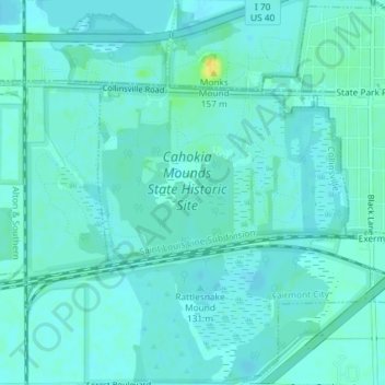
Name: Cahokia Mounds State Historic Site topographic map, elevation, terrain.
Average elevation: 128 m
Minimum elevation: 123 m
Maximum elevation: 145 m
Make a donation
Gear up for your next adventure:
As an Amazon Associate, this site earns from qualifying purchases at no extra cost to you.