
Flynn topographic map
Click on the map to display elevation.
About this map
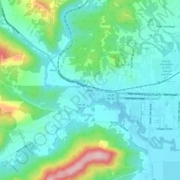
Name: Flynn topographic map, elevation, terrain.
Location: Flynn, Benton County, Oregon, 97370, United States (44.52095 -123.40677 44.56095 -123.36677)
Average elevation: 124 m
Minimum elevation: 72 m
Maximum elevation: 292 m