
Revin topographic map
Interactive map
Click on the map to display elevation.
About this map
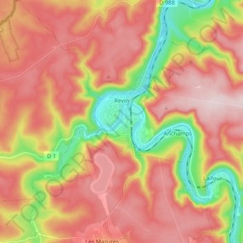
Name: Revin topographic map, elevation, terrain.
Average elevation: 305 m
Minimum elevation: 113 m
Maximum elevation: 447 m
Other topographic maps
Click on a map to view its topography, its elevation and its terrain.
Sainte-Marie
Sainte-Marie, Vouziers, Ardenas, Gran Este, Francia metropolitana, 08400, Francia
Average elevation: 111 m