Geolocate

Gibanga topographic map

Click on the map to display elevation.

About this map
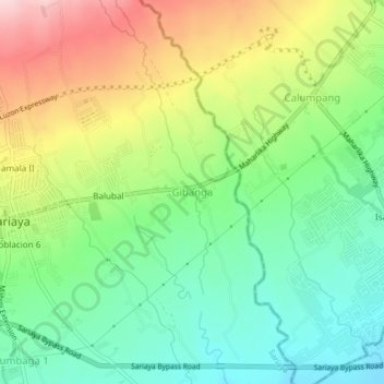
Name: Gibanga topographic map, elevation, terrain.

Location: Gibanga, Sariaya, 2nd District, Quezon, Calabarzon, 4322, Philippines (13.94602 121.52398 13.98602 121.56398)

Average elevation: 182 m

Minimum elevation: 79 m

Maximum elevation: 347 m

Other topographic maps

Click on a map to view its topography, its elevation and its terrain.
Barangay Mamala 2

Philippines > Quezon > Sariaya

Average elevation: 217 m

Poblacion 2

Philippines > Quezon > Sariaya

Average elevation: 206 m

Malaking Tubig River

Philippines > Quezon > Sariaya

Average elevation: 9 m

Gear up for your next adventure:

👟Sport Hiking Sandals - Breathable footwear for water crossings and camp rest
🦌Outdoor Trail Camera - Monitor wildlife activity near your favorite spots
⛺Camping Groundsheet - Protect your tent from moisture and dirt
🥾Trekking Poles - Adjustable trekking poles to reduce knee stress and improve stability
🧼Biodegradable Camp Soap - Environmentally friendly cleaning for gear and body

As an Amazon Associate, this site earns from qualifying purchases at no extra cost to you.