
Salamá topographic map
Interactive map
Click on the map to display elevation.
About this map
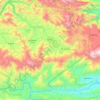
Name: Salamá topographic map, elevation, terrain.
Location: Salamá, Baja Verapaz, Guatemala (14.87157 -90.45080 15.24082 -89.99827)
Average elevation: 1,188 m
Minimum elevation: 292 m
Maximum elevation: 2,518 m
Other topographic maps
Click on a map to view its topography, its elevation and its terrain.
Cuchilla del Nogal
Guatemala > Baja Verapaz > Salamá > Cuchilla del Nogal
Cuchilla del Nogal, Salamá, Baja Verapaz, Guatemala
Average elevation: 1,683 m