Geolocate

San Martín topographic map

Click on the map to display elevation.

About this map

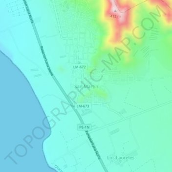
Name: San Martín topographic map, elevation, terrain.

Location: San Martín, Chancay, Provincia de Huaral, Lima, Perú (-11.53878 -77.30738 -11.49878 -77.26738)

Average elevation: 75 m

Minimum elevation: -1 m

Maximum elevation: 424 m

Gear up for your next adventure:

🥾Lightweight Hiking Shoes - Comfortable shoes for day hikes
🔥Emergency Fire Starter - Reliable ignition source for all weather conditions
🧦Crew Hiking Socks - Comfortable socks for long-distance hikes
🧰Multitool Knife - Compact and versatile tool for outdoor use
🗺️Topographic Maps - Detailed maps to explore trails, mountains, and wilderness areas

As an Amazon Associate, this site earns from qualifying purchases at no extra cost to you.