Geolocate

Snows Pond topographic map

Click on the map to display elevation.

About this map

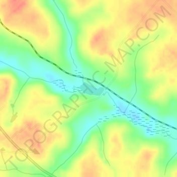
Name: Snows Pond topographic map, elevation, terrain.

Location: Snows Pond, Twiggs County, Georgia, United States (32.63787 -83.29579 32.63995 -83.29139)

Average elevation: 132 m

Minimum elevation: 105 m

Maximum elevation: 154 m

Gear up for your next adventure:

🧥Insulated Jacket - Keep warm in cold outdoor conditions
🥾Waterproof Hiking Boots - Essential footwear for rugged terrain and wet Canadian trails
🥾Lightweight Hiking Boots - Boots for comfort and mobility on long hikes
🕯️Camping Lantern - Illuminates your entire campsite with high-efficiency LEDs
🧥Softshell Jacket - Windproof and breathable jacket for hiking

As an Amazon Associate, this site earns from qualifying purchases at no extra cost to you.