Geolocate

Cocullo topographic map

Click on the map to display elevation.

About this map

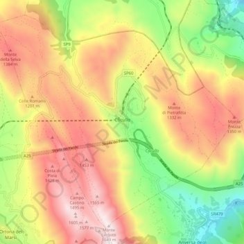
Name: Cocullo topographic map, elevation, terrain.

Location: Cocullo, L'Aquila, Abruzzo, Italy (41.99884 13.72206 42.06533 13.82380)

Average elevation: 1,063 m

Minimum elevation: 443 m

Maximum elevation: 1,660 m

Gear up for your next adventure:

🧢Sun Protection Cap - Breathable cap to protect from sun exposure
🎒Hiking Daypack - Lightweight and durable backpacks for day trips and excursions
🔋Emergency Crank Radio - Weather alerts and power without needing batteries
🥾Hiking Gaiters - Protect legs and shoes from mud, snow, and debris
🧊Portable Cooler - Keep food and drinks cold during outdoor adventures

As an Amazon Associate, this site earns from qualifying purchases at no extra cost to you.