Geolocate

Bonot topographic map

Click on the map to display elevation.

About this map
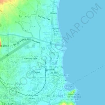
Name: Bonot topographic map, elevation, terrain.

Location: Bonot, Legazpi, Albay, Bicol Region, 4500, Philippines (13.13815 123.73185 13.17815 123.77185)

Average elevation: 7 m

Minimum elevation: 0 m

Maximum elevation: 52 m

Other topographic maps

Click on a map to view its topography, its elevation and its terrain.

Tibu River

Philippines > Albay > Legazpi > Tamaoyan

Average elevation: 4 m

Mayon Volcano

Philippines > Albay > Legazpi

Average elevation: 519 m

Sawangan Park

Philippines > Albay > Legazpi

Average elevation: 7 m

Kalayaan Park

Philippines > Albay > Legazpi

Average elevation: 7 m

Gear up for your next adventure:

🕯️Camping Lantern - Illuminates your entire campsite with high-efficiency LEDs
🧦Merino Wool Socks - Moisture-wicking comfort for long-distance hiking
🔦UV Flashlight - Detect minerals or specific insects in the dark
🛶Waterproof Dry Bags - Keep electronics and clothes dry during river crossings
🔦LED Headtorch - Bright and durable light for night activities

As an Amazon Associate, this site earns from qualifying purchases at no extra cost to you.